The Northwest Shipwreck Alliance has developed a number of hardware and software tools for locating and exploring Underwater Cultural Resources. These tools are based on simple designs and inexpensive components, each one fills a role in the discovery process. The NSA is sharing these designs with anybody who is interested in building and operating similar equipment. SolidWork CAD files are available upon request.
All of these tools are rated to 1000 meters.
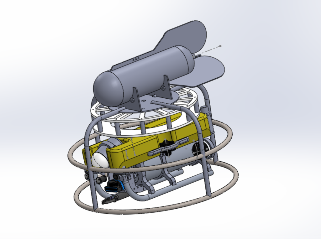
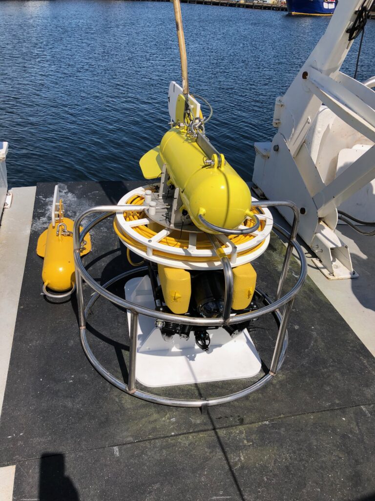
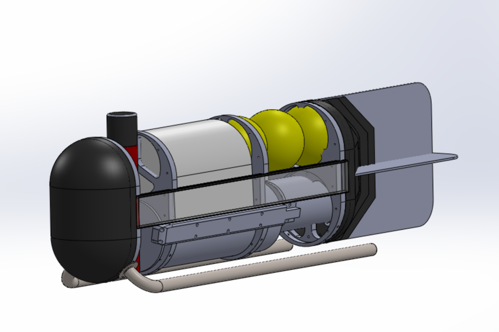
Blazer ROV: The ROV was designed to operate on a single coax. It is capable of sending two video streams, imaging sonar and ROV control on a 1200 meter cable. The electronics on the ROV are accessible without disconnecting any of the underwater connectors. This simplifies troubleshooting and wear and tear on the connectors. The ROV is configured with an Oculus imaging sonar.
Blazer Towfish: This simple design is used with a lead filled depressor to facilitate better imaging in heavy seas. The depressor goes up and down with the swell but the sidescan operates in the quiet with little to no pitch on the towfish, resulting in better image quality.
Blazer Multiplexing software: This software is used to manage NMEA 0183 and NMEA 2000 data flow to and from navigation computers, sonars, and tracking systems.
Wayback Layback Software: We developed this tool to use with towed sonars. It takes in data from a cable counter, depth sensor and heading sensor to calculate the location of the towfish. It also has a smoothing feature which improves side scan imagery in heavy seas. We found this tool to be extremely useful and accurate enough to undertake towed surveys in 1000 meters of water without an underwater tracking system.